ABSAMETOV MALIS
Doctor of Sciences (Geol.-Min.),
Professor, Academician of the NAS RK
The purpose of the program:
Regional assessment and mapping of groundwater flow under climatic and anthropogenic changes on the territory of Kazakhstan to clarify the prognostic resources of fresh and slightly saline groundwater resources.
Program objectives:
1.Generalization and analysis of factual data, stock and analytical materials on the peculiarities of formation and results of previous groundwater flow assessments in Kazakhstan.
2. Justification and selection of the methodology for zoning the territory of Kazakhstan by groundwater basins.
3. Regional surveys of groundwater basins in Kazakhstan to assess anthropogenic factors influencing groundwater formation.
4 Analyses and assessment of trends in climatic changes in groundwater basins in Kazakhstan.
5.Justification and choice of methodology for regional groundwater flow assessment and groundwater flow mapping on the territory of Kazakhstan.
6.Development and creation of a geoinformation-analytical subsystem of the results of groundwater flow assessment in the territory to clarify the forecast resources of fresh and slightly saline groundwater.
7.Development and creation of regional maps of Kazakhstan's groundwater flow and natural and forecast fresh and slightly saline groundwater resources.
8.Justifying areas for hydrogeological prospecting, evaluation and exploration works for fresh and slightly saline groundwater.
Groundwater flow, a key component of the global hydrological cycle, is the process of groundwater movement from the recharge areas to the discharge areas under the force of hydraulic head and gravity. It plays a vital role in assessing groundwater resource potential. However, the last comprehensive assessment of groundwater flow in Kazakhstan was conducted in 1961-1963. In the current century, no regional groundwater flow assessment has been carried out, making the proposed program a pressing need.
Groundwater, considered a natural resource in many countries, derives its practical value mainly from renewable resources (groundwater flow) and, in exceptional cases, from non-renewable resources (groundwater storage capacity), which can be exploited and depleted. The latter also acts as an essential buffer, making the abstraction regime of renewable resources less dependent on the natural rhythm of recharge. It's worth noting that experts estimate the global groundwater flow to vary between 12-14 thousand km3/year, while only up to 8.3 % of global water is abstracted. The estimated groundwater flow for the territory of Kazakhstan is up to 0.4% of the global one, underscoring the practical significance of our research in the context of water resource management and sustainability.
Only a tiny part of the world's groundwater resources is available for human use, yet this amount represents an enormous freshwater reserve. In a world of increasing demand for water, where surface water resources are scarce and increasingly stressed, the value of groundwater will gradually be recognised by all, as it was by many ancient civilisations millennia ago.
The scientific novelty of the Program includes justification and selection methodology of the territory of Kazakhstan on groundwater flow basins; analysis and assessment of trends under climatic and anthropogenic changes on groundwater flow basins on the territory of the country; justification and selection methodology for the regional evaluation and mapping of groundwater flow; development and creation a geoinformation-analytical subsystem of groundwater flow, assessment results for specification of renewable and regional forecast resources of fresh and slightly mineralised groundwater resources.
The program addresses strategic challenges through its objectives and targets: State of the Nation Address by President of the Republic of Kazakhstan Kassym-Jomart Tokayev "A fair state. United nation. Welfare society" dated from 01.09.2022; President Kassym-Jomart Tokayev`s State of the Nation Address "Economic course of a Just Kazakhstan" dated from 01.09.2023; General scheme of organisation of the territory of the Republic of Kazakhstan; Strategy "Kazakhstan 2050": a new political course of the established state; National projects "Green Kazakhstan" and "Technological boost through digitalisation, science and innovation".
EXPECTED AND ACHIEVED RESULTS: 2024 ye.
A generalisation and analysis of actual data, stock, and analytical materials on the peculiarities of formation and previous groundwater flow assessment results on the territory of Kazakhstan was carried out.
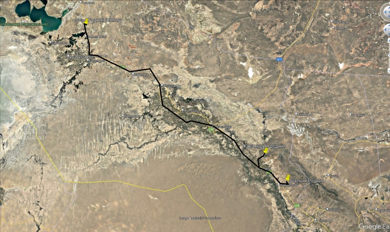
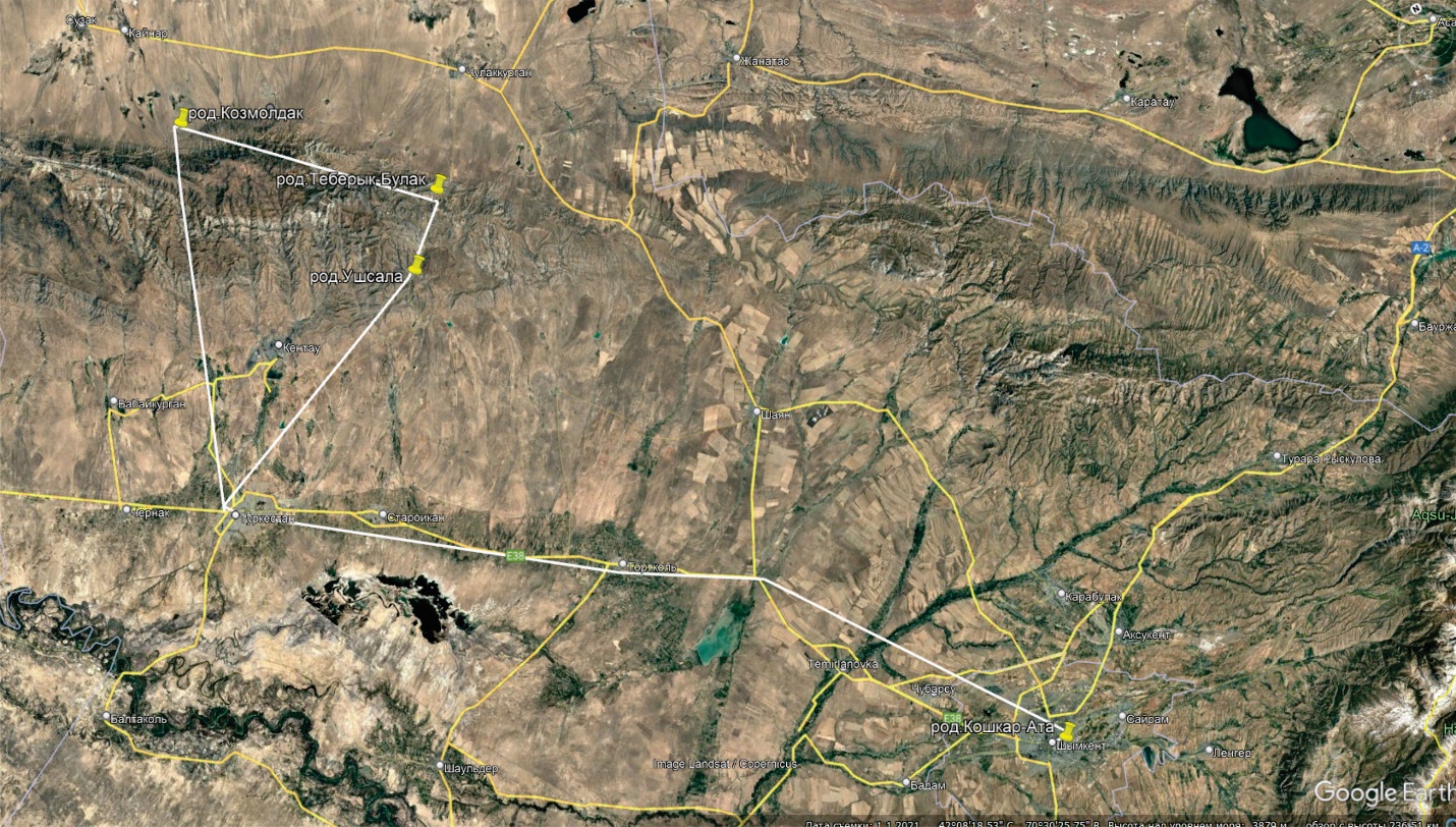
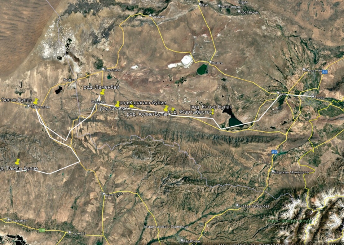
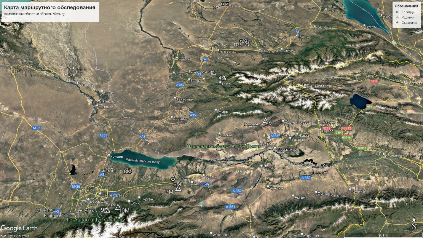
The justification and selection of methodology for the zoning of groundwater flow basins in South Kazakhstan (the Aral-Syrdarya, Shu-Talas, and Balkash-Alakol basins) were also considered.
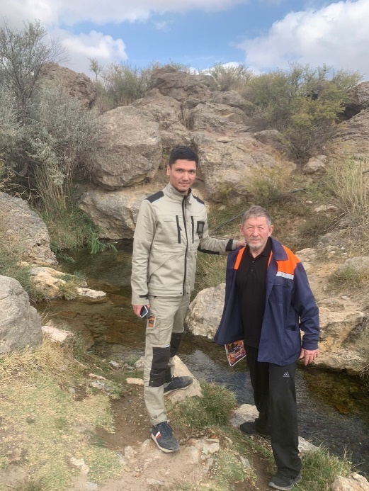
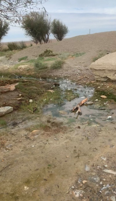
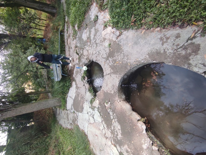
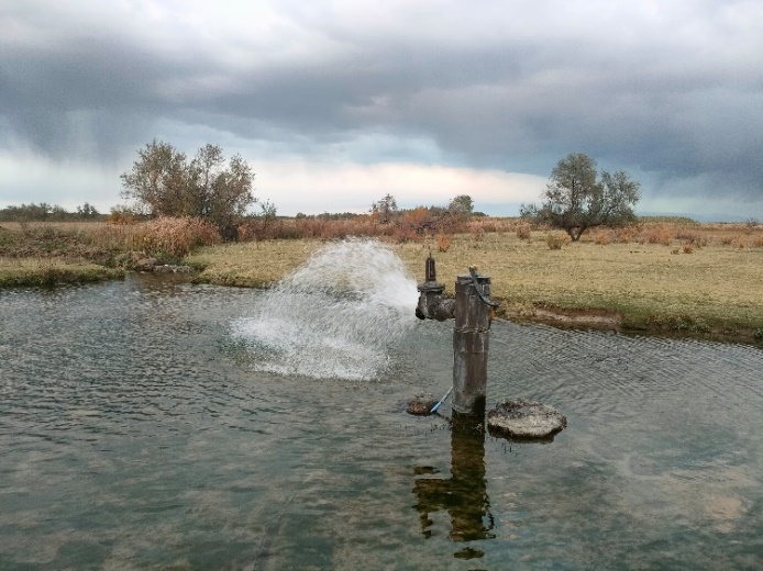
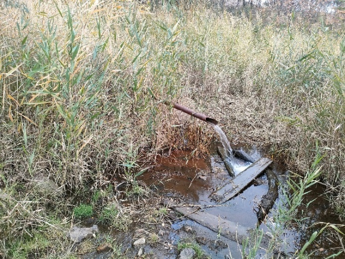
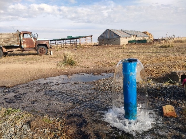
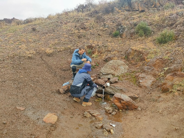
A series of regional expeditions were undertaken to assess the impact of anthropogenic activities on the formation of groundwater in the water management basins of South Kazakhstan. The basins encompassed in this study include Aral-Syrdarya, Shu-Talas and Balkash-Alakol. In addition to these regional expeditions, chemical-analytical studies were conducted on groundwater samples collected during these expeditions. During the routes, springs and hydrogeological wells were surveyed and tested, and the sanitary-ecological condition of spring sites and the technical condition of hydrogeological wells were assessed. Furthermore, groundwater samples were taken for laboratory tests. The total length of the route surveys was over 12,000 kilometres. A detailed inspection was conducted on five self-exploding hydrogeological wells and 24 springs, and 58 water samples were collected for subsequent chemical and laboratory analysis.
|
|
Kuttykozha spring |
Karamuryn spring |
Map of actual material and sampling points in the territory of the Kyzylorda region (Aral-Syrdarya WMB)
|
|
|
|
Akbastau spring |
Teberykbulak spring |
Map of actual material and sampling points in the Turkestan region (Aral-Syrdarya WMB and Shu-Talas WMB)
|
|
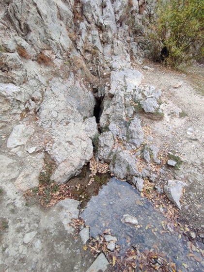
Auele-Bulak spring |
Tamdy Aulieu spring |
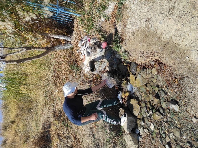
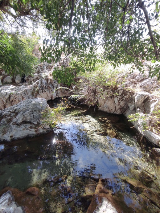
Map of actual material and sampling points in the Zhambyl region (Shu-Talas WMB)
|
|
|
|
|
|
well, Kyrbaltabay village |
Koramsky spring |
Map of actual material and sampling points in Almaty region (Balkash-Alakol WMB)
|
|
|
|
|
|
well, Karaşilık Village |
Shipaly Su spring |

Map of actual material and sampling points in the territory of the Zhetisu region (Balkash-Alakol WMB)
A series of regional expeditions were undertaken to assess the impact of anthropogenic activities on the formation of groundwater in the water management basins of South Kazakhstan. The basins encompassed in this study include Aral-Syrdarya, Shu-Talas and Balkash-Alakol WMB. In addition, a series of chemical-analytical studies were conducted on groundwater samples collected during these expeditions. During the routes, springs and hydrogeological wells were surveyed and tested, and the sanitary-ecological condition of spring sites and the technical condition of hydrogeological wells were assessed. Furthermore, groundwater samples were taken for laboratory tests. The total length of the route surveys was over 12,000 kilometres. A detailed inspection was conducted on five self-flowing hydrogeological wells and 24 springs, and 58 water samples were collected for subsequent chemical and laboratory analysis.
Overall, the following results were achieved following the implementation of the program in 2025:
Justification and selection of methods for zoning the underground drainage basins of the water management basins of Western and Northern Kazakhstan (Zhayik-Caspian and Tobyl-Torgai WMB) have been completed. The unity of groundwater and surface water is reflected in groundwater basins or ‘water exchange basins’, which represent the continental hydrogeological structure of the drained part of the earth's crust and its surface, within the boundaries of which the water balance is formed and the water cycle in nature takes place. Hydrogeological zoning by groundwater flow basins consists of identifying types of groundwater flow basins and establishing the taxonomic rank of basins. The zoning map by water exchange basins is combined with maps of structural-hydrogeological and geomorphological zoning, which ensures that the relationship between groundwater flow basins, hydrogeological and geomorphological structures is reflected.
Within the boundaries of the Zhayik-Caspian WMB, a closed Caspian continental basin of underground runoff has been identified, comprising one regional basin (Zhayik), four subregional basins (Kigash, Oiyil, Zhemsky and Sagizsky), and a closed zone. In structural and hydrogeological terms, the territory covers three regions: East Russian, Scythian-Turanian and Taimyr-Ural, within the boundaries of which there are 8 first-order groundwater basins and 13 second-order groundwater basins. In accordance with the geomorphological zoning, the continental Caspian WEB covers three geomorphological areas: the Caspian syncline, the Turan plate and the folded area of the Southern Urals and Mugalkhar, within which 11 geomorphological regions have been identified.
There are two regional WOBs located in the Tobol-Torgai WCB: the Tobyl WOB, which is part of the open continental basin of the Kara Sea, and the Torgai WOB, which is located within the closed continental Aral basin.
Within the boundaries of the Tobylsky WEB, there are 1 regional underground drainage basin – Tobylsky – and 2 subregional basins (Ubagansky and Toguzaksky). The hydrogeological structures are represented by the West Siberian and Taimyr-Ural regions, each of which contains one basin of the 1st and 2nd order. The Tobylsky WEB covers three geomorphological areas: the south of the West Siberian Plate and the folded area of the Southern Urals and Mugalkhar, within which three geomorphological regions have been identified
Within the Torgai WEB, one regional (Torgai) and four subregional (Yrgiz, Ul-Kayak, Uly-Zhilanshik, Naurzum-Sarykopinsky) underground drainage basins have been identified. The hydrogeological structures are represented by the Scythian-Turan, Taimyr-Ural and Central Kazakhstan regions, which comprise four first-order groundwater basins and six second-order groundwater basins. Three geomorphological areas have been identified: the Turan Plate, the folded region of the Southern Urals and Mugalkhar, and the Kazakh Shield with five geomorphological districts.
Regional expeditionary studies were carried out with water sampling in underground drainage basins to assess anthropogenic factors influencing the formation of groundwater within the administrative regions of the Western and Northern Kazakhstan WMB (Zhayik-Caspian and Tobyl-Torgay WMB). The total length of route surveys in the Zhayik-Caspian WMB was 3,404 km, four wells and twenty-eight springs were surveyed, and 32 water samples were taken for chemical laboratory studies. In the Tobyl-Torgai WMB, the length of the routes was 1,617 km, ten springs and two lakes formed as a result of self-discharge from wells were surveyed, and 12 water samples were taken for laboratory analysis.
Laboratory analysis of water samples taken from wells and springs was carried out by the Institute's Chemical Analysis Laboratory. Based on the results of chemical and analytical studies, water test reports and a summary table of groundwater quality indicators were compiled. The results of laboratory studies of groundwater samples were processed using the AquaСhem 11 software package.
Within the Zhayik-Caspian WMB, two groups have been identified based on groundwater quality. The first (West Kazakhstan and Aktobe regions) is characterised by favourable conditions, the presence of fresh groundwater with low and medium mineralisation, generally complying with sanitary standards, with the exception of individual sources with excessive levels of nitrates, chlorides, sulphates and hardness. The second group (Atyrau and Mangistau regions) is characterised by an extremely unfavourable hydrochemical situation, where highly mineralised chloride-sodium waters with hardness levels many times higher than the standards are widespread, and cases of exceedances of nitrates, fluoride, petroleum products and mercury.
The hydrogeochemical condition of groundwater in the Tobol-Turgai WMB is characterised as predominantly favourable. The waters in the south of the region are of stable quality: they have low mineralisation, neutral reaction and low content of nitrates, nitrites, petroleum products and heavy metals. The Kostanay region is characterised by greater contrast in quality: most of the groundwater is also fresh, soft and complies with sanitary standards, but some sources have been identified with high mineralisation, elevated chloride and sulphate content, and high hardness. In addition, a number of springs have been found to have significantly higher than normal nitrate concentrations, while petroleum products and heavy metals have not been detected in samples or are present only in trace amounts.
Analysis and assessment of climate change trends in the underground drainage basins of the water management basins of Southern and Western Kazakhstan (Aral-Syr Darya, Shu-Talas, Balkhash-Alakol and Zhayik-Caspian WMB) have been carried out. On average across Kazakhstan for the period 1976–2023, the average annual air temperature has increased by 0.36ºC every 10 years. The water management basins of Southern and Western Kazakhstan are experiencing faster rates of warming (from 0.47 °C/10 years to 0.56 °C/10 years).
The warming trend for the winter season within Kazakhstan is 0.24°C/10 years. The most noticeable rate of increase in winter temperature, at 0.34-0.50°C/10 years, has been observed in the Zhayik-Caspian and Aral-Syr Darya water management basins. In the mountainous regions of the Shu-Talas and Balkhash-Alakol climatic zones, there is a trend towards a decrease in temperature of up to -0.4 °C/10 years. In summer, the average air temperature in Kazakhstan increases by 0.24°C/10 years. The highest rates of air temperature increase are observed in the Zhayik-Caspian climatic region - by 0.32-0.89°C/10 years. Less intense warming is observed in the Aral-Syr Darya, Shu-Talas and Balkhash-Alakol climatic zones. In the western region (Zhayik-Caspian climatic zone), climate warming is observed in all seasons of the year.
The nature of contemporary changes in Kazakhstan's precipitation regime has been determined by evaluating time series of anomalies in annual and seasonal precipitation totals for the period 1941-2023, calculated relative to the base period 1961-1990 and spatially averaged across the territory. The average annual precipitation across Kazakhstan decreased in the 1960s and 1970s, with no long-term trends observed in the last 40 years. There was an alternation of short periods with positive and negative anomalies in the amount of atmospheric precipitation. In most climatic zones, the trends towards both an increase and a decrease in annual precipitation are insignificant. In the western part of the Aral-Syr Darya climate zone and the southern part of the Zhayik-Caspian climate zone, precipitation decreased at a rate of 4.7 and 5.0% of the norm per 10 years. There is patchiness in the direction of change in seasonal and monthly precipitation.
In winter, increased precipitation was recorded in the coastal zone and southern part of the Zhayik-Caspian VHB, the Aral Sea region and the eastern part of the Balkhash-Alakol VHB. A trend towards a decrease in winter precipitation within 7-12% of the norm/10 years is observed in the northern part of the Zhayik-Caspian VHB, in the desert areas of the Aral-Syrdarya, Shu-Talas and Balkhash-Alakol VHBs. In summer, a vast area of reduced precipitation covers most of the Zhayik-Caspian climatic region, reaching up to -16% of the norm/10 years. A trend towards increased summer precipitation is observed in the coastal part of the Northern Caspian Sea, north of Lake Balkhash, and in the southern and south-eastern parts of the Aral-Syrdarya, Shu-Talas and Balkhash-Alakol hydrological basins.
Based on the analysis and summarisation of international and domestic experience, the rationale and selection of methods for regional assessment of groundwater flow and mapping of groundwater flow in the territory of the Southern and Western Kazakhstan VHB (Aralo-Syrdarya, Shu-Talas, Balkhash-Alakol and Zhayik-Caspian VHB). The regional assessment determined the average characteristics of underground runoff for fairly large areas within the VOB (individual river valleys, the first aquifers from the surface, sandy massifs). Widely used methods were employed, including: assessment of infiltration recharge based on atmospheric precipitation and groundwater level regime, hydrodynamic calculation of underground flow, dismemberment of river hydrographs and low-water river flow, analysis of the average annual water balance of groundwater recharge or discharge areas. The methods used for regional assessment of groundwater flow complement each other, with the most reliable results achieved when used in combination. To monitor regional groundwater recharge values, data from exploration and prospecting work at deposit sites were analysed.
ArcGIS – Intersect software tools, which are part of the Analysis Tools group, were used to map regional groundwater flow. Groundwater flow was assessed and mapped as a natural (renewable) groundwater resource through a joint assessment of groundwater flow due to atmospheric precipitation infiltration and surface runoff filtration.
Section 5. A GIS was developed and created based on the results of the assessment of groundwater flow to refine the forecast resources of fresh and slightly mineralised groundwater in the Western and Northern Kazakhstan aquifers (Zhayik-Caspian and Tobyl-Torgai aquifers). Cartographic materials related to the assessment of natural groundwater resources by territory have been entered into the GIS. They are presented in the form of lithological maps; maps of the distribution of average annual precipitation and average annual river runoff; maps of the average annual coefficient of groundwater flow as a percentage of precipitation, and maps of groundwater flow as a percentage of total river flow. All maps are constructed in a single coordinate system and on a single cartographic basis, representing a systematic set of data on the territory. All graphic objects are linked to attribute information. The maps show diagrams of the ratio of areas with different values of average annual precipitation and average annual river runoff. Additional information on groundwater deposits and the results of expeditionary surveys have been entered into the system.
Regional maps of underground flow, natural and projected resources of fresh and slightly mineralised groundwater in the VHB of Southern and Western Kazakhstan (Aralo-Syrdarya, Shu-Talas, Balkhash-Alakol and Zhayik-Caspian VHB).
The initial data for the formation of the map of natural (renewable) groundwater resources is the information presented by the GIAS on the results of the assessment of underground flow. Natural resources are calculated by superimposing polygonal layers of GIAS. The groundwater flow module is used to visualise quantitative information about resources. GIAS includes refined maps of the projected operational resources of groundwater in the VHB of Southern and Western Kazakhstan. The maps of projected resources of fresh and slightly mineralised groundwater were updated in the process of adjusting the areas of projected resource modules, zones of distribution of water with different mineralisation, as well as the contours of the main aquifers and complexes. For the specified regions, the value of projected resources was calculated by combining cartographic data on the distribution of modules and zones with different water mineralisation.
№ |
Full name, education, degree, academic title |
Main place of work, position |
Hirsch index, Researcher ID, ORCID, Scopus Author ID identifiers |
1 |
Absametov Malis Kudysovich, KazPTI named after V.I.Lenin, specialty: hydrogeology and engineering geology, Doctor of Geological and Mineral Sciences, Professor, Academician of the National Academy of Sciences of the Republic of Kazakhstan |
IHEG, Director |
H-index 5 (Scopus), |
2 |
Vladimir Mirlas, Doctor of Technical Sciences |
Senior Researcher, Department of Chemical Engineering, Ariel University, Ariel, Israel. |
H-index 7 (Scopus), |
3 |
Rakhimov Timur Aitkalievich, KazNRTU named after K.I. Satpayev, specialty: Hydrogeology and engineering geology, PhD |
"Akhmedsafin Institute of Hydrogeology and Environmental Geoscience " LLP (hereinafter referred to as IHEG), Head of the Laboratory of Regional Hydrogeology and Geoecology |
H-index 3 (Scopus), |
4 |
Adenova Dinara Kiyzbaevna, |
IHEG, Senior Scientific Researcher of Laboratory of Hydrogeological and Geoecological Processes Modeling |
H-index 4(Scopus), |
5 |
Mukhamedzhanov Murat Abikenovitch, |
IHEG, Chief Scientific Researcher, Laboratory of Regional Hydrogeology and Geoecology |
H-index 3, (Scopus), |
6 |
Sapargaliev Daniyar Serikovich, KazNRTU named after. K.I. Satpayev, specialty: hydrogeology and engineering geology, Master's degree and a doctoral student |
IHEG, Executive Secretary for Innovation |
|
7 |
Toktar Aliya Toleubaykyzy, Russian State Geological Prospecting University, named after. S. Ordzhonikidze, Moscow, |
IHEG, scientific researcher of |
|
8 |
Nurgaziyeva Asel Azatkalievna, |
IHEG, junior scientific researcher of laboratory of regional hydrogeology and geoecology |
H-index 3 |
9 |
Kiktev Valentin Aleksandrovich, |
IHEG, lead engineer of the laboratory of regional hydrogeology and geoecology |
ORCID: 0009-0009-8556-9493 |
10 |
Kanafin Marat Utegenovich, |
IHEG, lead engineer, laboratory of regional hydrogeology and geoecology |
|
11 |
Nurmukhambetova Bakhyt Isakhanovna, |
IHEG, scientific secretary |
|
12 |
Murtazin Yermek Zhamshitovich, KazPTI named after V.I.Lenin, specialty: hydrogeology and engineering geology, Candidate of Geological and Mineral Sciences |
IHEG, Deputy Director for Science |
H-index 4 (Scopus), |
13 |
Adilova Lyailya Maratovna, Kazakh State Pedagogical University named after Abai, speciality: chemistry-biology |
IHEG, head of the testing sector, Laboratory of Chemical Analytical Research |
|
14 |
Bagiman Orken, Sofia Mining Institute, specialty: Hydrogeology and engineering geology |
IHEG, 1st category Engineer of the laboratory of regional hydrogeology and geoecology |
|
15 |
Kulbekova Roza Abdizhapparovna, KazNU, named after Al-Farabi, has a speciality in chemistry and is a master of ecology. |
IHEG, senior scientific researcher, Laboratory of Chemical Analytical Research |
H-index 2(Scopus), |
16 |
Iskanderov Rustam Ruslanovich, KazNRTU named after. K.I. Satpayev, specialty: hydrogeology and engineering geology, master's degree |
IHEG, junior scientific researcher, laboratory of industrial and geothermal waters |
H-index 2(Scopus), |
17 |
Yusupov Marcel Nurmukhamedovich |
IHEG, Equipment Engineer for Laboratory of Chemical Analytical Research |
|
18 |
Koshpanova Kalamkas Eskatkyzy, |
IHEG, lead Engineer, Laboratory of Chemical Analytical Research |
ORCID: 0000-0002-5230-0545 |
19 |
Yermek Ultu, |
IHEG, 1st category Engineer, Laboratory of Chemical Analytical Research |
|
20 |
Li Bin-Chin Olga Sergeevna, Kazakh State Agrarian University, Speciality: agroecology |
IHEG, 1st category Engineer, Laboratory of Chemical Analytical Research |
|
21 |
Kirilova Vera Ivanovna, Tashkent Hydrometeorological College Specialty: meteorologist |
IHEG, 2nd category Engineer, Laboratory of Chemical Analytical Research |
|
22 |
Jabassov Abay Maratovich, |
IHEG, head of the laboratory of groundwater resources |
Researcher ID:GSI-4322-2022 |
23 |
Livinsky Yuri Nikolaevich, |
IHEG, Leading Scientific Researcher Laboratory of Groundwater Resources |
H-index 3, |
24 |
Yermenbay Arai Musakyzy, |
IHEG, scientific researcher, Laboratory of Groundwater Resources |
H- index 3, |
25 |
Kulagin Vitaly Vasilievich, KazPTI named after V.I. Lenin, specialty: hydrogeology and engineering geology |
IHEG, lead engineer of the laboratory of GIS technologies and remote sensing |
H-index 3, |
26 |
Zhakibayeva Aigerim Zhanatovna, KazNRTU named after K.I. Satpayev, Specialty: Geology and Mineral Exploration, Master of Science in hydrogeology and engineering geology, a doctoral student |
IHEG, junior scientific researcher Laboratory of Groundwater Resources |
|
27 |
Bazarbaeva Gulnara Orumbaevna, KazPTI named after V.I. Lenin, |
IHEG, junior scientific researcher Laboratory of Groundwater Resources |
|
28 |
Sembayev Daulet Birzhanuly, KazNRTU, named after K.I. Satpayev, specialty: Geology and Mineral exploration, Master of technical sciences in hydrogeology and engineering geology |
IHEG, lead engineer, the laboratory of groundwater resources |
ORCID: 0009-0000-5236-9772 |
29 |
Tukesheva Gulzira, |
IHEG, leading scientific researcher Laboratory of Groundwater Resources |
|
30 |
Chensizbayev Daniyar Borashuly, KazNRTU named after K.I. Satpayev, specialty: Master of Hydrogeology and Engineering Geology, doctoral student |
IHEG, junior scientific researcher, laboratory of industrial and geothermal waters |
|
31 |
Nurpeisov Rauan Akhmetovich, KazNRTU named after K.I. Satpayev, specialty: Hydrogeology and Engineering geology |
IHEG, Lead Engineer of the laboratory of industrial and geothermal waters |
|
32 |
Umarov Timur Sadykovich, KazGASA Specialty: Construction, Master's degree in oil and gas engineering |
IHEG, 1st category engineer of the laboratory of industrial and geothermal waters |
|
33 |
Onlasynov Zhuldyzbek Alikhanuly, KazNRTU, named after K.I. Satpayev, specialty: Hydrogeology and Engineering Geology, PhD |
IHEG, Head Of The Laboratory Of GIS Technologies And Remote Sensing Of The Earth |
H-index 1, |
34 |
Myrzagaziyeva Rashilya Mubarakovna, Kazakh National Technical University named after K.I. Satpayev Specialty: Computer Software and Automated Systems |
IHEG, Lead Engineer |
|
35 |
Akynbaeva Madina Zhakypzhanovna, KazNU named after. Al-Farabi, Specialty: Geography, Master's degree in ecology |
IHEG, Junior Scientific Researcher laboratory of GIS technologies and remote sensing of the Earth |
ORCID ID: 0000-0002-9543-1457 |
36 |
Muratova Mira Muratovna, |
IHEG, Lead Engineer of the laboratory of GIS technologies and remote sensing of the Earth |
H-index 2, |
37 |
Usenov Dosbol Nurkenuly, KazNU named after Al-Farabi, specialty: Cartography, Master's degree |
IHEG, 1st category engineer of the laboratory of GIS technologies and remote sensing of the Earth |
ORCID: 0000-0001-9814-0164 |
38 |
Sotnikov Evgeniy Vladimirovich, |
IHEG, Head of the Laboratory for Modeling Hydrogeological and Geoecological Processes |
H-index 2, |
39 |
Tleuova Zhanna Tursynovna, |
IHEG, Scientific Researcher laboratory of industrial and geothermal waters |
|
40 |
Smolyar Vladimir Alexandrovich, |
IHEG, Chief Scientific Researcher Laboratory of Regional Hydrogeology and Geoecology |
H-index 1, |
41 |
Miroshnichenko Oksana Leonidovna, KazNU, named after S.M. Kirov, specialty:Applied Mathematics, Candidate of Technical Sciences |
IHEG, Leading Scientific Researcher – laboratories for modeling hydrogeological and geoecological processes |
H-index 5, |
42 |
Rakhimova Valentina Stanislavovna, KazNRTU, named after K.I. Satpayev, specialty: hydrogeology and engineering geology, PhD |
IHEG, senior scientific researcher, laboratory for modeling hydrogeological and geoecological processes |
H-index 1 |
43 |
Tazhiev Sultan Rysniyazovich, |
IHEG, Scientific Researcher laboratory for modeling hydrogeological and geoecological processes |
H-index 1, |
44 |
Rakhmetov Isa Kanatovich, |
IHEG, Junior Scientific Researcher |
H-index 2, |
45 |
Vyalov Valery Dmitrievich, KazPTI named after V.I. Lenin, specialty: hydrogeology and engineering geology |
IHEG, Lead Engineer of the laboratory of industrial and geothermal waters |
|