
RAKHIMOV TIMUR
Head of the laboratory, PhD
The purpose of the project:
Scientific substantiation of the creation of circulating systems, artificial aquifers using the methods of infiltration and accumulation with the capture of flood, temporary, descending and drainage waters formed in the valleys of rivers crossing the foothill plain.
Program objectives:
- Scientific substantiation, development and assessment of the prospects for using technology for replenishing groundwater reserves through infiltration of flood, groundwater and wastewater, intermittent streams into non-confined aquifers lying near the surface.
- Substantiation and implementation of the method of accumulating river flow of flood waters into melt water storage ponds with their subsequent use for the needs of the agricultural sector. Research of the prospects and technical capabilities of artificial replenishment of reserves due to gravity infiltration involves flooding a diked area, installing special basins with a dense network of small canals, and using the beds of permanent and intermittent streams.
- Development of technology for the creation and implementation of sub-irrigation systems based on the integrated use of non-traditional irrigation sources under water resource shortages caused by the climate changes.
- Scientific substantiation, development and assessment of the prospects of using modern irrigation systems, water-saving technologies in experimental areas of agricultural development with the introduction of non-traditional irrigation sources.
- Hydro-geo-ecological monitoring support for the implementation of the Program objectives to ensure safe methods for the integrated use of irrigation and groundwater on irrigated lands.
- Development of an electronic GIS database of technologies of the obtained research data based on the creation of physical and development of computer models of an experimental system for the accumulation of river flows of flood waters in storage ponds.
Attracting additional water resources for irrigation from local sources will increase the reliability of irrigated agriculture in small agricultural settlements without the cost of building centralized irrigation systems through the most efficient use of local runoff and groundwater, when depending on soil, hydrological conditions and terrain.
A significant reduction in irrigation water losses and a decrease in the volume of mineralized drainage flow will contribute to the improvement of the ecological and reclamation state of irrigated lands and the source of collector and drainage water discharge.
EXPECTED AND ACHIEVED RESULTS: - 2024 ye.
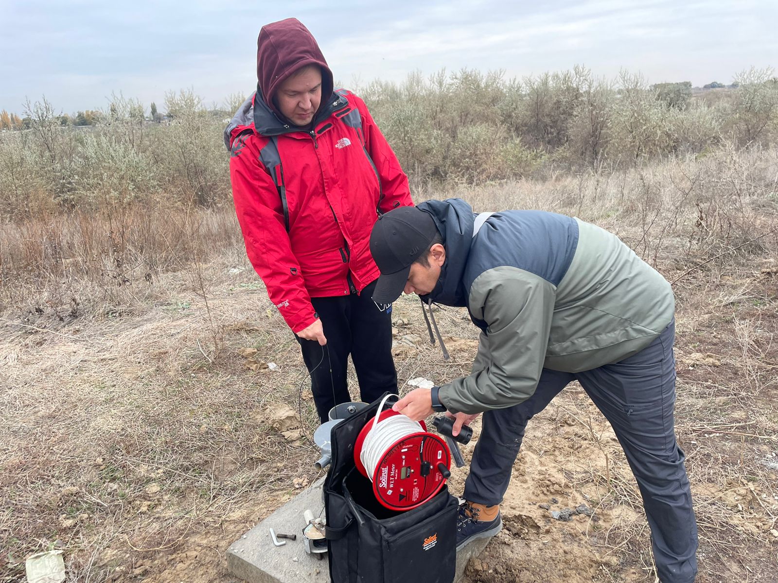
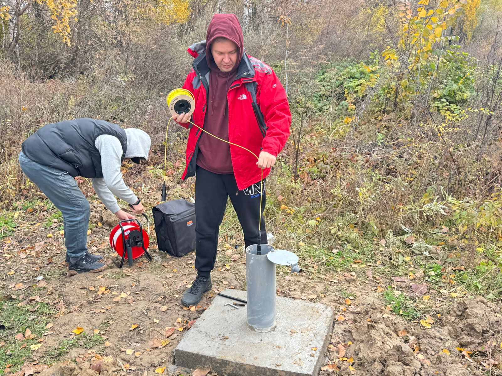
The analysis of factual data, publications and analytical materials based on domestic experience in artificial replenishment of groundwater reserves and circulating water use systems was carried out; A field survey of the work area was carried out. An experimental site has been selected for scientific research. 5 monitoring wells have been drilled. Hydrogeological parameters of the aquifer were obtained. The wells are equipped with Solins loggers with the ability to remotely measure the level and temperature of groundwater. 7 samples of surface water and groundwater were tested.
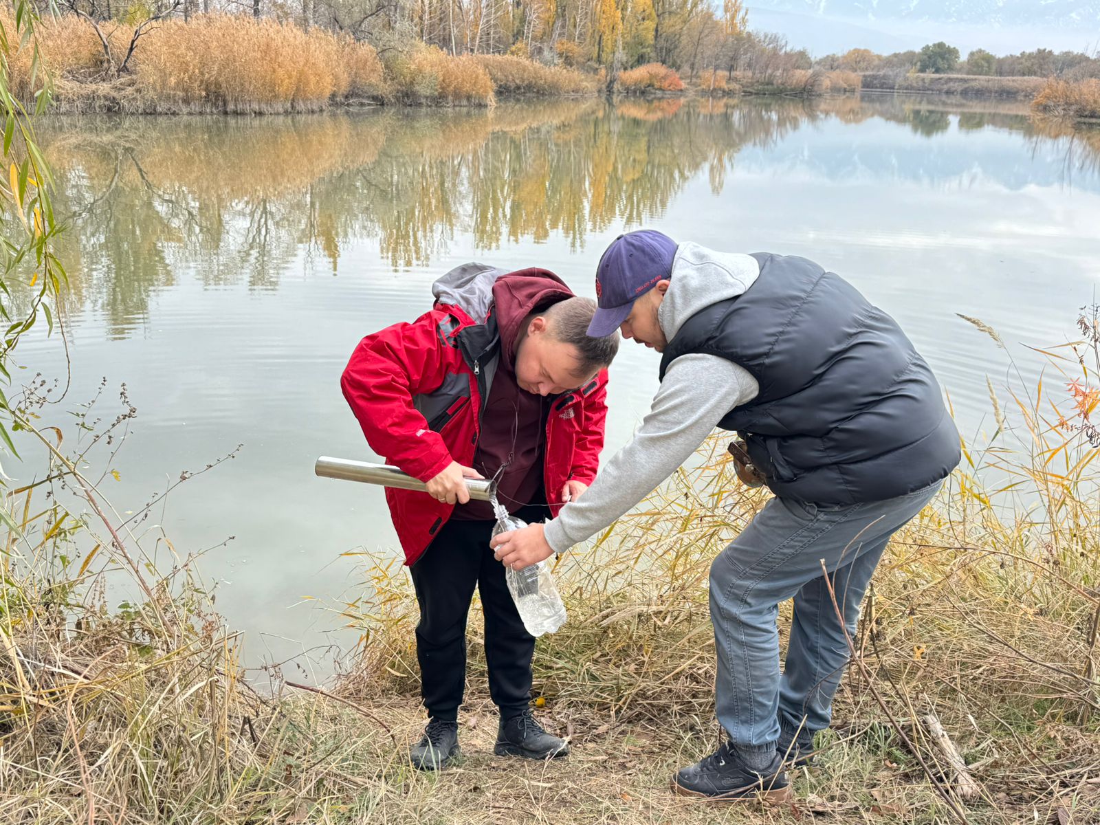
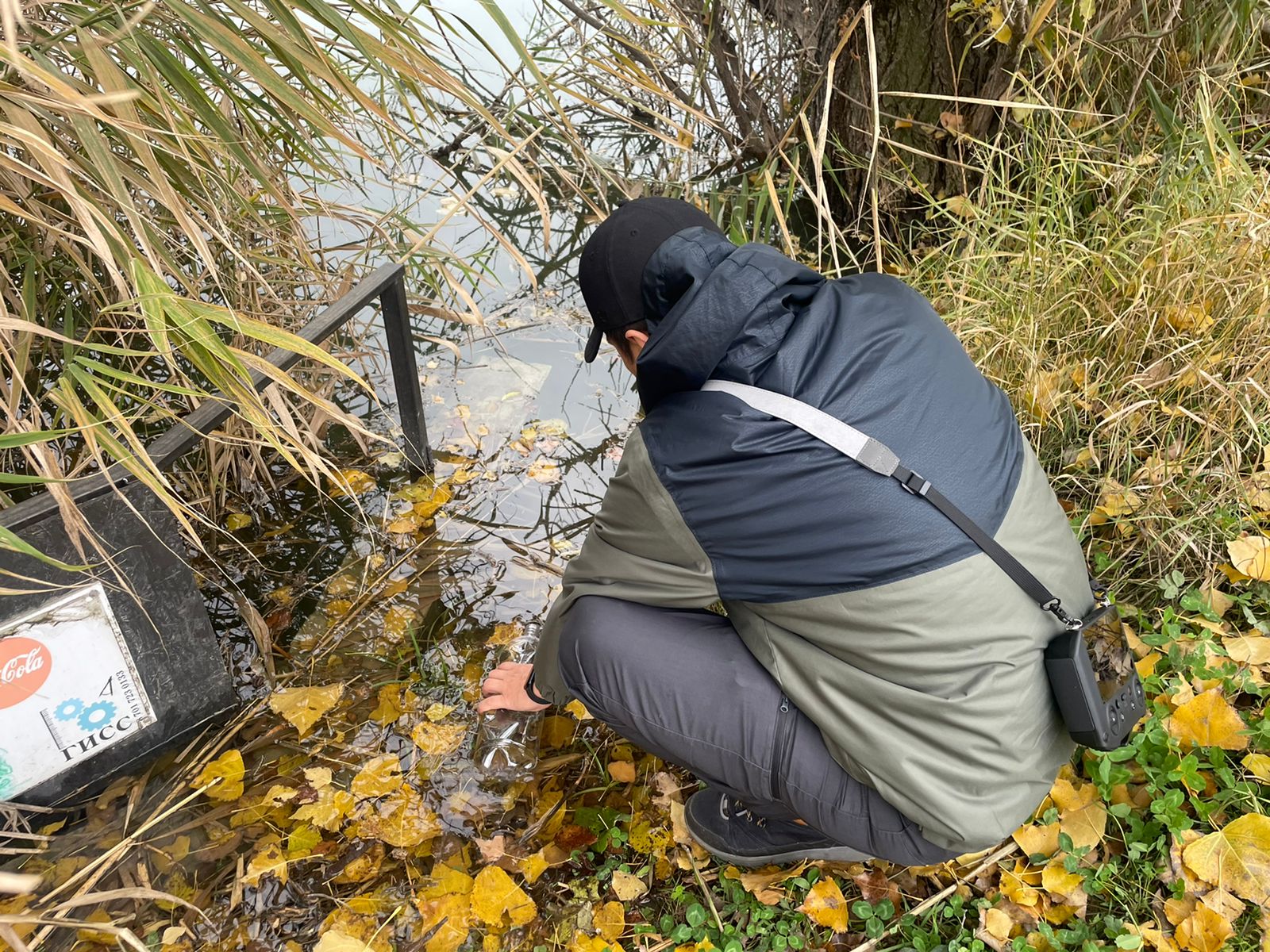
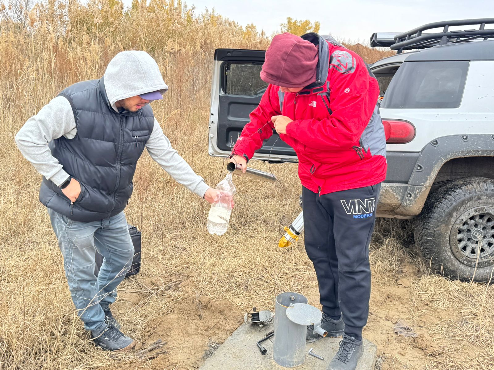
Laboratory studies were carried out on 7 samples of surface water and groundwater water. The chemical indicators of the selected water samples were analyzed for the suitability of their use for irrigation.
A regime network consisting of 5 wells has been created to study the level and temperature of groundwater, as well as to monitor the level and salt regime of groundwater and assess the impact of various anthropogenic and natural factors on groundwater.
Topographic survey was carried out using the DJI Mavic 3M UAV and the DJI D-RTK 2 mobile base.
Water-energy-saving environmentally friendly technologies for the integrated and effective use of flood, collector-drainage and groundwater, local runoff on irrigated lands of the Enbekshikazakh district of the Almaty region will be developed and recommended by agricultural producers for implementation.
According to the grant project schedule for 2024–2026, 2025 was a pivotal stage involving the collection of representative experimental data and the establishment of a robust scientific foundation for evaluating the effectiveness on water circulation systems in irrigation amidst water scarcity. The main expectations for this stage were the deepening of field and laboratory research, the development of instrumental monitoring of surface and groundwater, and the creation of an extensive geoinformation database offering an integrated analysis of hydrological, hydrogeological and agroecological processes.
The expected outcomes were to obtain reliable information on the operating regime of seasonal regulation reservoirs and the dynamics of the groundwater level in their area of influence, as well as the quality of the surface and groundwater. The role of backwater and infiltration in the formation of the sub-irrigation effect on irrigated lands was also to be assessed. It was assumed that the collected data would justify the controlled use of surface water and groundwater within water circulation systems, providing a basis for further recommendations.
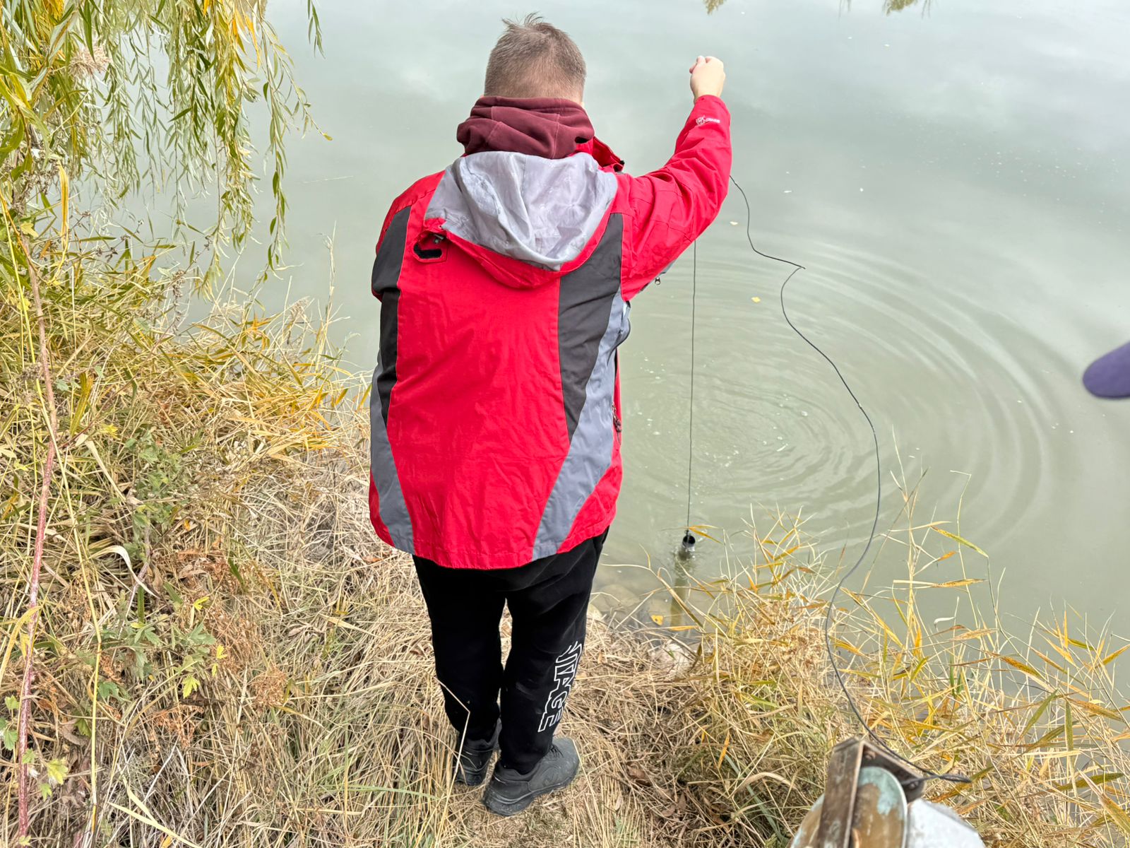
In fact, the set goals had been fully achieved by 2025. A series of fieldwork activities were carried out, including the reading and processing of data from automatic loggers measuring groundwater levels and temperatures in observation wells. This made it possible to obtain a continuous series of observations for the period from November 2024 to October 2025. The map of the experimental site (Figure 1) shows the spatial location of observation wells, storage ponds, and irrigation network elements, as well as field survey routes. The obtained time series of data enabled the average groundwater levels, the amplitudes of seasonal fluctuations and the influence of the backwater from the storage ponds to be estimated. This is clearly reflected in the graphs showing the dynamics of the groundwater level regime (Figure 2).
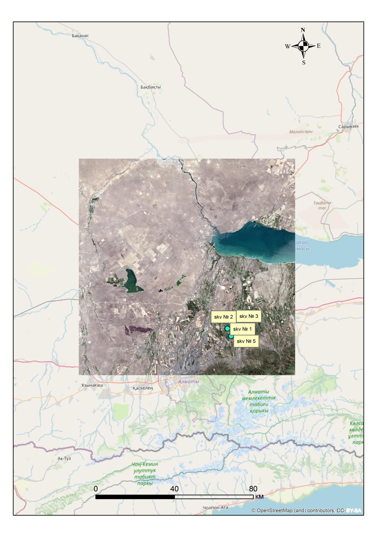
Figure 1 - Map of the location of the storage ponds, the irrigation network and the observation wells at the experimental site.
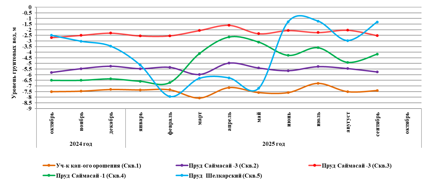
Figure 2 – Groundwater level dynamics based on data from automatic loggers in 2024–2025.
In 2025, laboratory studies were conducted on the chemical composition of surface and groundwater samples taken from storage ponds and monitoring wells. The hydrochemical data obtained enabled the mineralisation, ionic composition, acid-alkaline conditions and individual indicators determining the water's suitability for irrigation to be characterised.
A significant practical outcome in 2025 was the production and installation of extra regulating and water metering structures on the right branch of the Shiletty irrigation canal. The diagrams and photographs (Figure 4) show the design schemes of the gate valves and portable spillways, as well as their location in the canal system. Commissioning these structures has improved the controllability of irrigation water distribution and the accuracy of flow measurement at sectional and intra-farm canal levels.
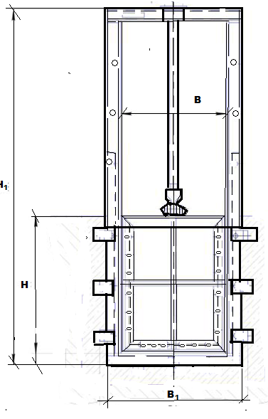
|
Shutter type
|
Drive type |
Dimensions, mm |
Name of indicators |
|||||
|
L |
В1 |
Н1 |
Time for full opening/closing of the valve, min. |
Estimated force on the handwheel, kgf
|
Stroke of the shield, mm
|
Weight, kg |
||
|
Flat, sliding with seal |
Manual, screw |
2000 |
1000 |
1000 |
1 |
2,0 |
800 |
56 |
Figure 4 - Diagram showing the location of the shield gates and portable spillways on the Shilekty Canal.
During the reporting year, the hydrological regime of the Shalkar, Saimasay-1 and Saimasay-3 seasonal regulation reservoirs was monitored on a stationary basis. Detailed information was obtained on the dynamics of water levels, as well as changes in total and useful volume and surface area. Figure 5 clearly presents the patterns of the ponds' hydrological regime formation during the hydrological year in the form of block diagrams, reflecting the relationship between water levels, volumes, and surface areas.
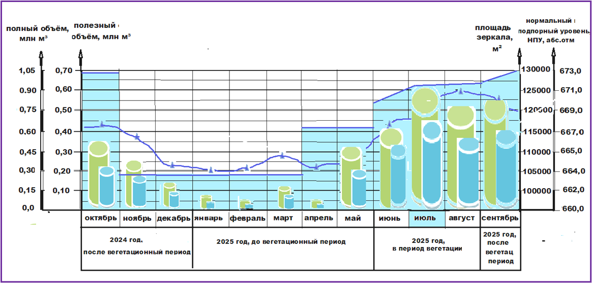
Figure 5 – Block diagrams showing the dynamics of the hydrological regime of storage ponds in 2024–2025.
In addition, an assessment of the condition of irrigated land was carried out in 2025 based on remote sensing data from Earth. Using Sentinel-2 satellite images at the peak of the growing season enabled areas showing signs of water stress and secondary soil salinisation to be identified. Figure 6 shows the spatial distribution of the calculated spectral indices and the identified problem areas, confirming the high informative value of remote sensing methods for monitoring the agroecological condition of land.
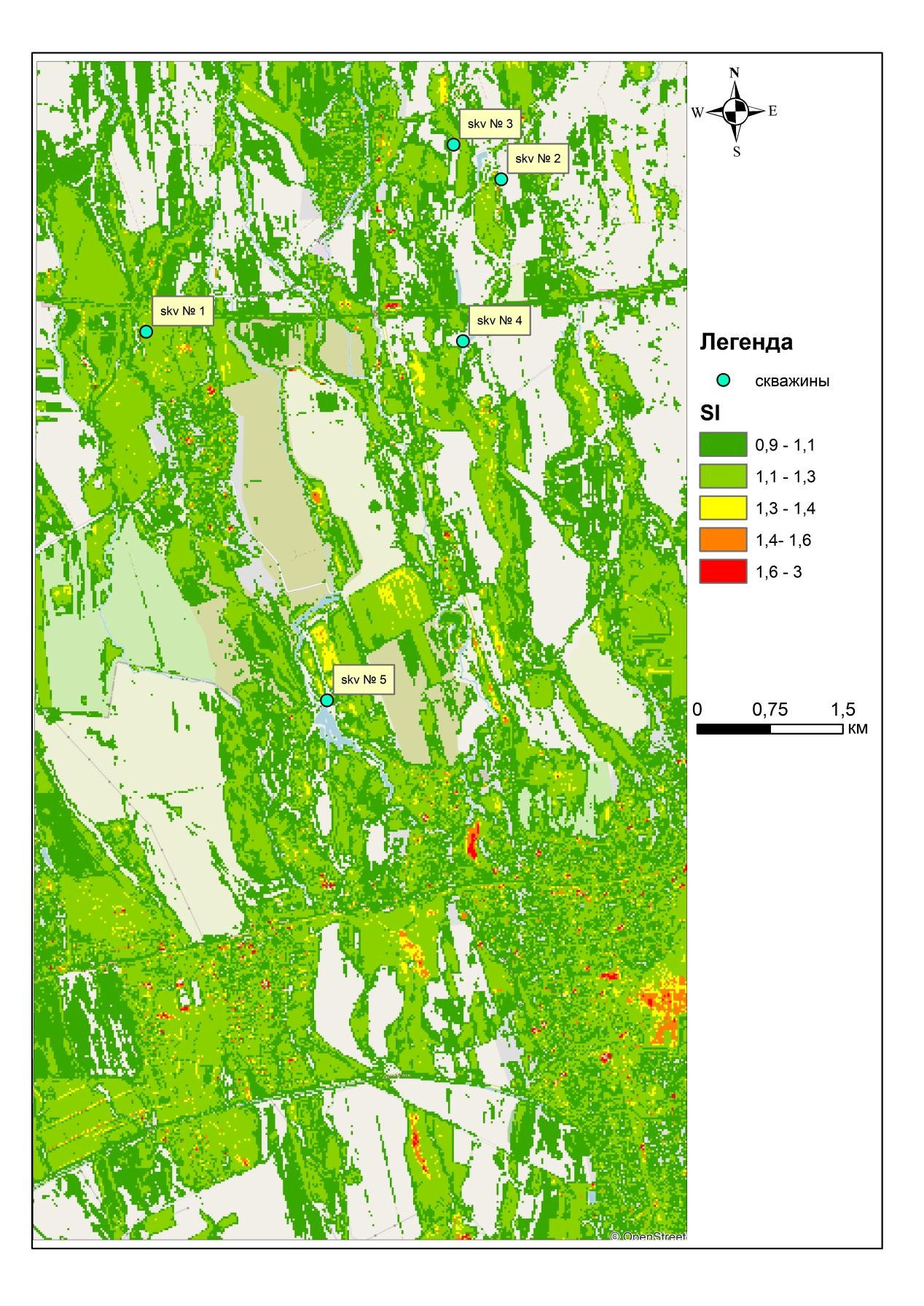
Figure 6 - Maps showing the distribution of salinity and water stress indices, based on Sentinel-2 data.
At the same time, the geoinformation system database was developed and populated with materials from field observations, laboratory analyses, routine measurements and remote sensing data.
The results achieved in 2025 provided an overall comprehensive and clearly interpretable picture of how water circulation systems function at the experimental site. They confirmed the systems' significant potential in conditions of water scarcity and created a solid scientific and informational basis for the next stage of the project. This stage involves developing practical recommendations and scenarios for the sustainable management of surface and groundwater.
No. |
Full name, education, degree, academic title |
Main place of work, position |
Hirsch index, Researcher ID, ORCID, Scopus Author ID identifiers |
1. |
Rakhimov Timur Aitkalievich, KazNRTU named after K.I. Satpayev, specialty: Hydrogeology and engineering geology, PhD |
"Akhmedsafin Institute of Hydrogeology and Environmental Geoscience " LLP (hereinafter referred to as IHEG), Head of the Laboratory of Regional Hydrogeology and Geoecology |
H-index 3 (Scopus), |
2. |
Kulagin Vitaly Vasilievich, KazPTI named after V.I. Lenin, specialty: hydrogeology and engineering geology |
IHEG, lead engineer of the laboratory of GIS technologies and remote sensing |
H-index 3, |
3. |
Rakhimova Valentina Stanislavovna, KazNRTU named after K.I. Satpayev, specialty: hydrogeology and engineering geology, PhD |
IHEG, senior scientific researcher, laboratory for modeling hydrogeological and geoecological processes |
H-index 1 |
4. |
Onlasynov Zhuldyzbek Alikhanuly, KazNRTU named after K.I. Satpayev, specialty: Hydrogeology and Engineering Geology, PhD |
IHEG, Head Of The Laboratory Of GIS Technologies And Remote Sensing Of The Earth |
H-index 1, |
5. |
Toktar Aliya Toleubaykyzy, Russian State Geological Prospecting University, named after. S. Ordzhonikidze, Moscow, KazNRTU named after K.I. Satpayev, specialty: hydrogeology and engineering geology, Master |
IHEG, scientific researcher of laboratory of regional hydrogeology and geoecology |
|
6. |
Nurgaziyeva Asel Azatkalievna, |
IHEG, junior scientific researcher of laboratory of regional hydrogeology and geoecology |
H-index 3 |